

Great Lakes Education Resources
Great Lakes Literacy Principles
Great Lakes literacy is an understanding of the Great Lakes' influences on you and your influence on the Great Lakes.
- The Great Lakes, bodies of fresh water with many features, are connected to each other and to the world ocean.
- Natural forces formed the Great Lakes; the lakes continue to shape the features of their watershed.
- The Great Lakes influence local and regional weather and climate.
- Water makes Earth habitable; fresh water sustains life on land.
- The Great Lakes support a broad diversity of life and ecosystems.
- The Great Lakes and humans in their watersheds are inextricably interconnected.
- Much remains to be learned about the Great Lakes.
- The Great Lakes are socially, economically, and environmentally significant to the region, the nation and the planet.
Center for Great Lakes Literacy
The vision of the Center for Great Lakes Literacy (CGLL) is to develop a Great Lakes-literate public capable of effectively contributing to the environmental, economic and social sustainability of the Great Lakes. CGLL is a collaborative effort led by Sea Grant educators throughout the Great Lakes watershed. It offers a number of lessons for download, from board games to outdoor activities.
Michigan Sea Grant
Michigan Sea Grant provides a wide variety of educational resources, from brochures and posters to lesson plans.
Teaching Great Lakes Science: Lessons & Data Sets: Lessons and data sets are organized into modules. The lessons found in each module are related to the same core concepts; however, each lesson stands on its own and can be explored in any order. Each lesson consists of a summary, learning objectives and a background that provides a detailed overview of the subject being explored. Data sets include background as well as the actual data collected around the Great Lakes.
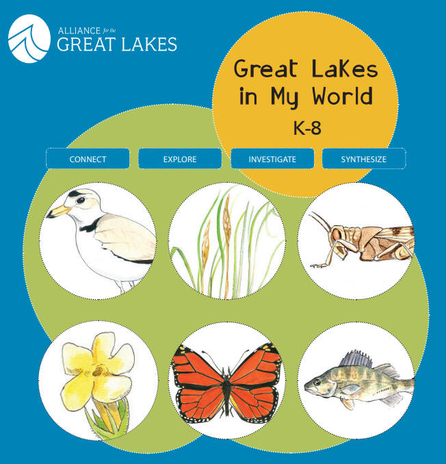
Alliance for the Great Lakes
The Alliance for the Great Lakes provides a variety of lessons about the Great Lakes for kids in grades K-8.
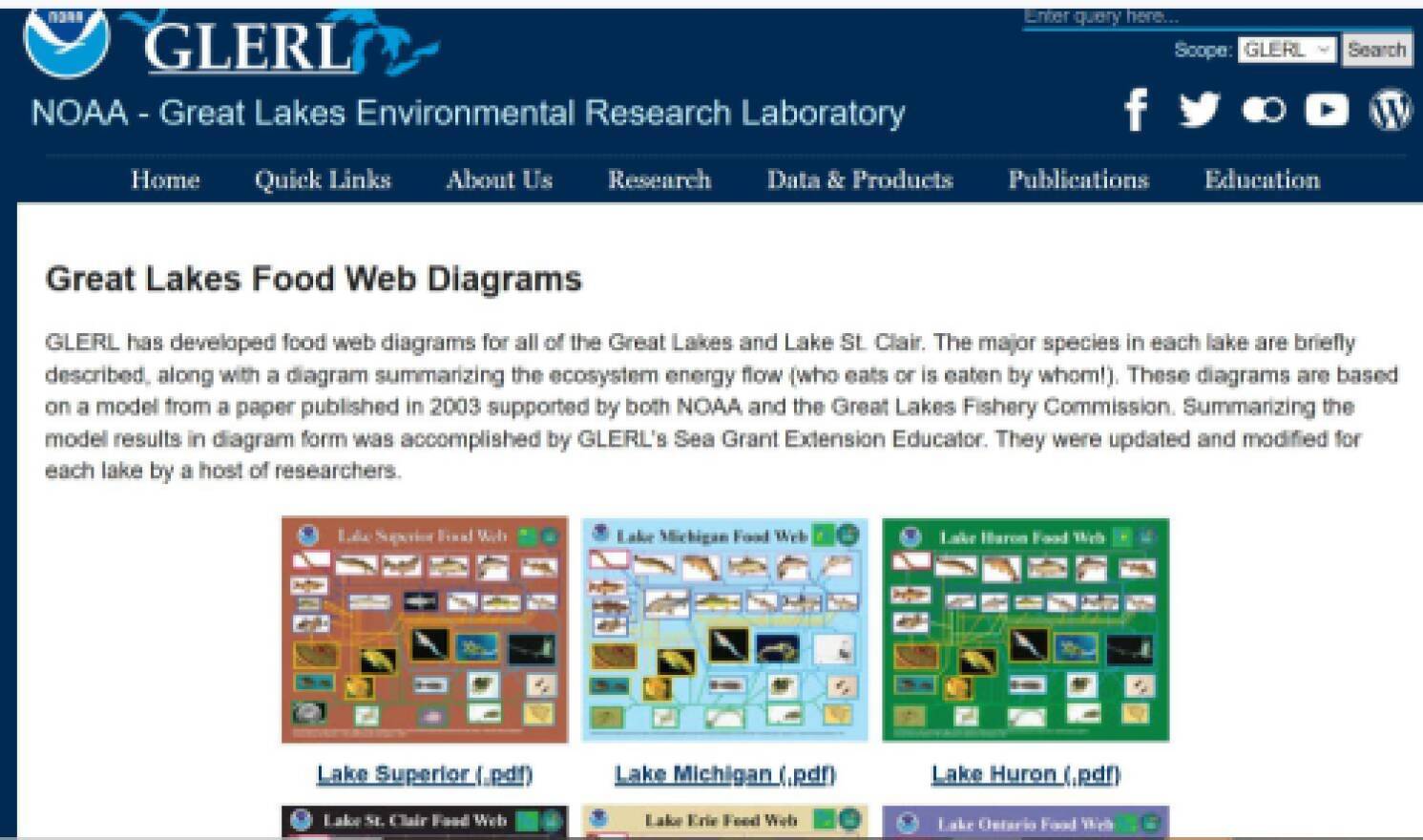
Great Lakes Food Webs
The Great Lakes Environmental Research Laboratory (GLERL) has developed food web diagrams for all of the Great Lakes and Lake St. Clair. The major species in each lake are briefly described, along with a diagram summarizing the ecosystem energy flow (who eats or is eaten by whom!).
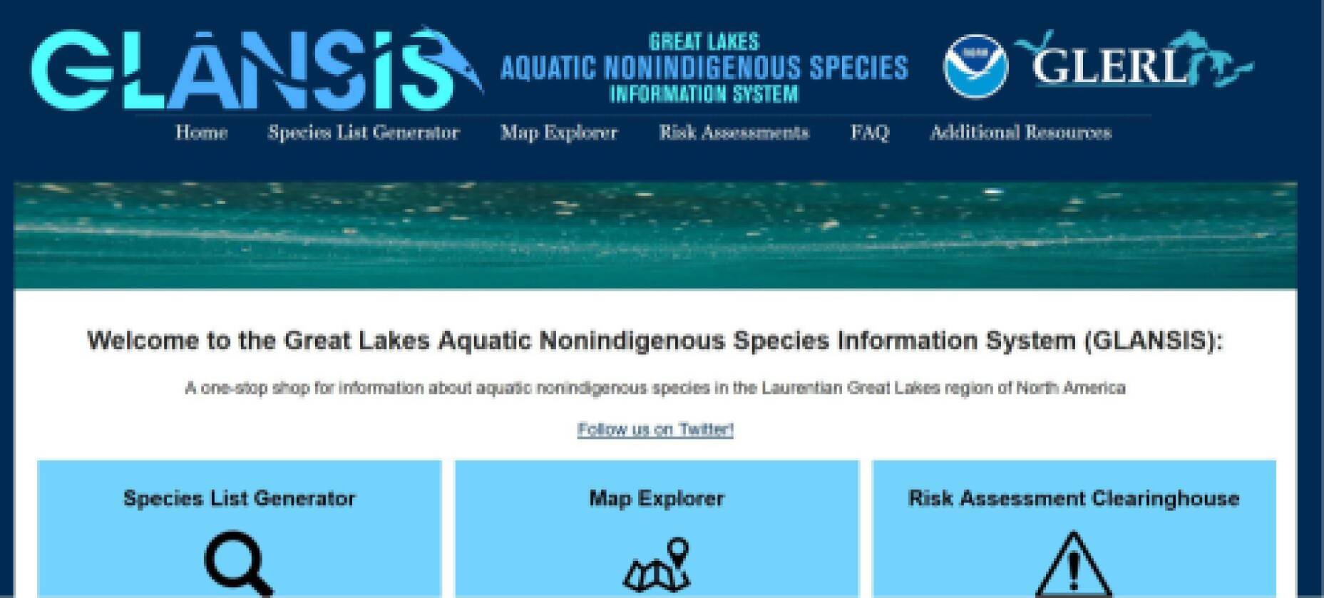
Great Lakes Aquatic Nonindigenous Species Information System (GLANSIS)
GLANSIS is a one-stop website that is all about invasive species in the Great Lakes.
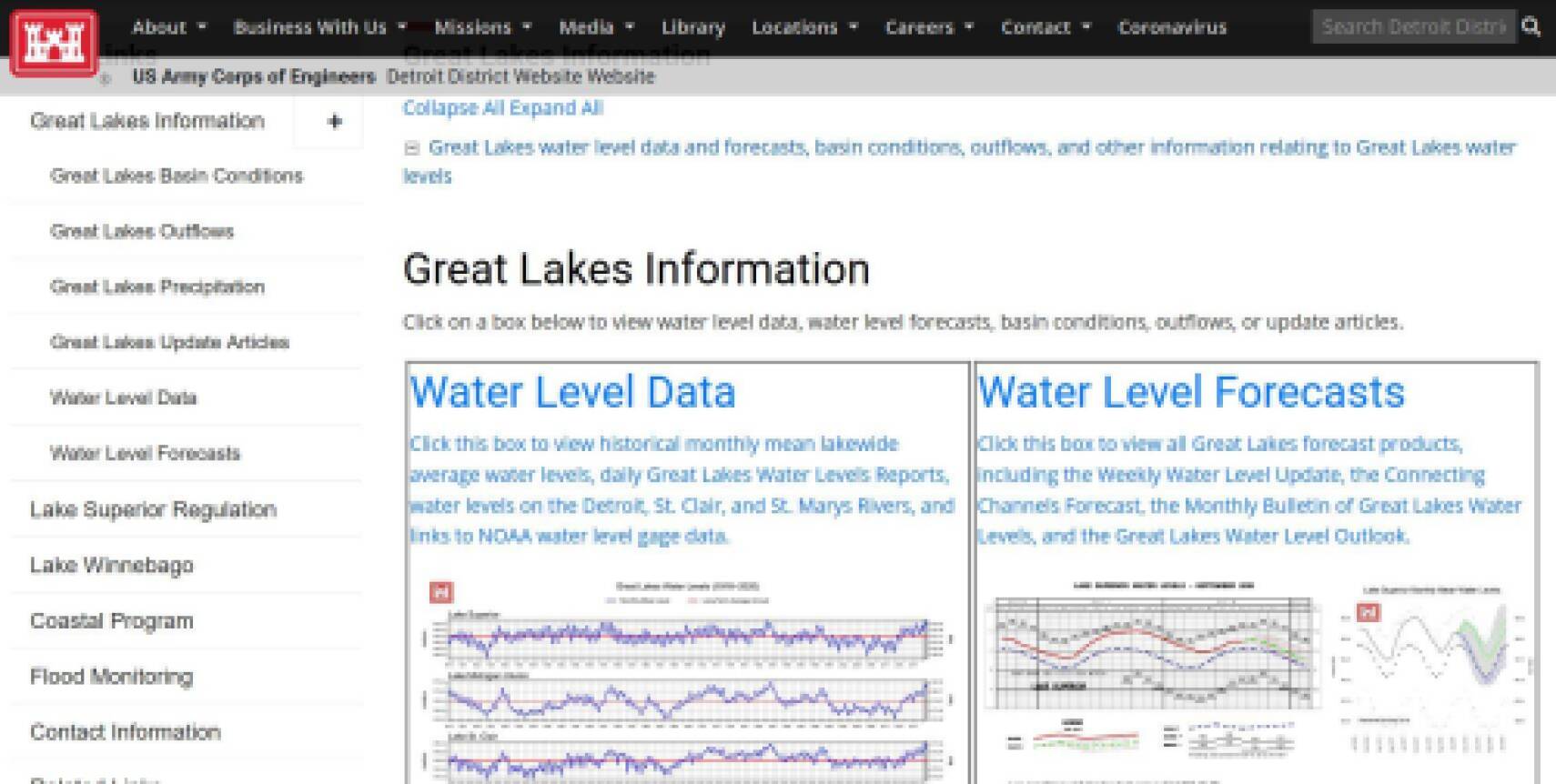
Great Lakes Water Levels
The U.S. Army Corps of Engineers tracks water levels and forecasts in the Great Lakes. Other products are basin conditions and outflows.
Great Lakes Observing System
The Great Lakes Observing System provides end-to-end data services that support science, policy, management, and industry in the Great Lakes.
Data is made available by partners throughout the region and includes:
- Point observations (winds, waves, water temperature, water levels, air temperature, dissolved oxygen, streamflow, and turbidity)
- Satellite observations (base reflectivity including weather hazards, chlorophyll concentration, colored dissolved organic matter, dissolved organic carbon, natural color, suspended minerals, and water surface temperature)
- Model forecasts (currents, ice thickness, water level, waves, and winds)
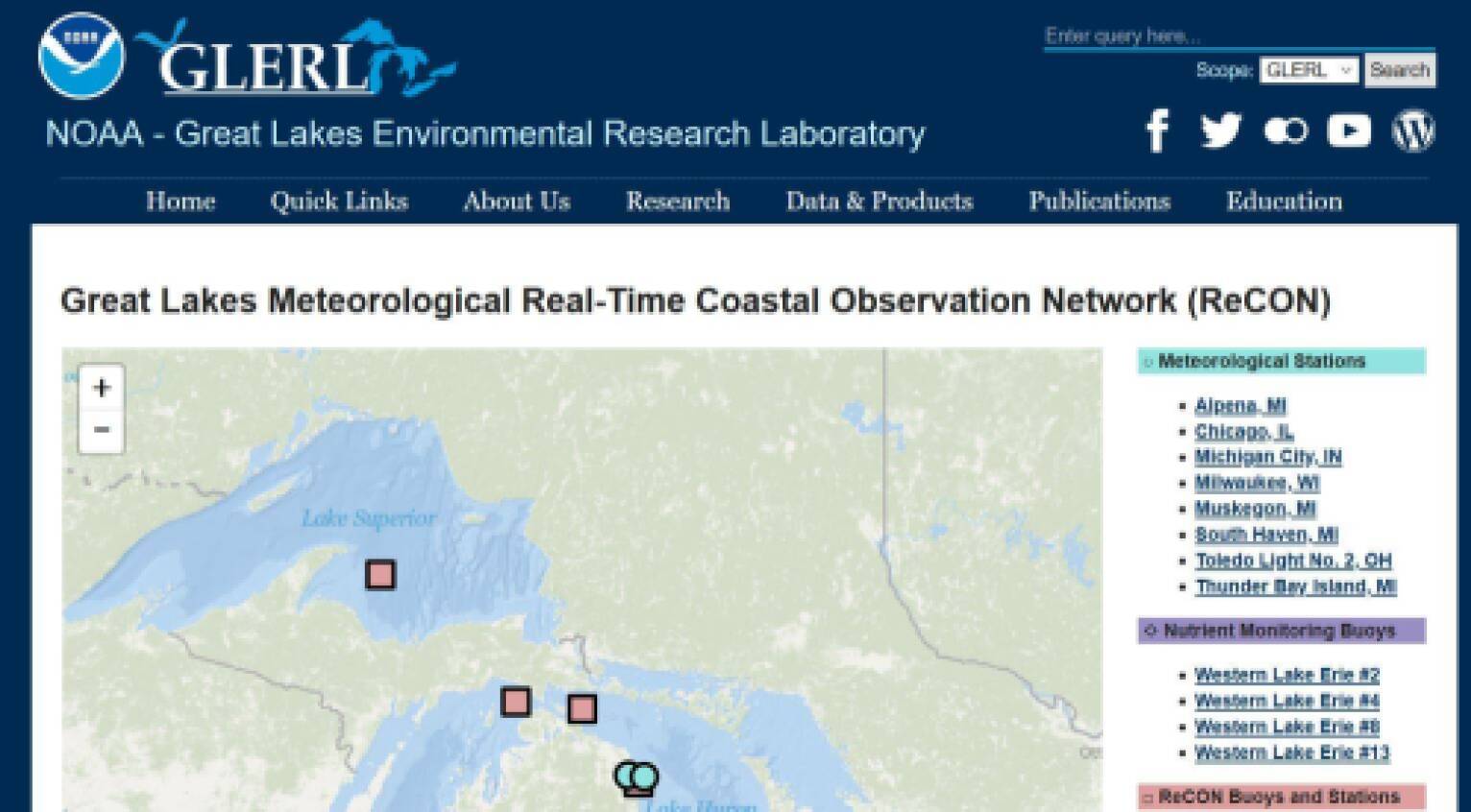
Great Lakes Meteorological Real-Time Coastal Observation Network (ReCON)
ReCON has data and webcam observations from throughout the Great Lakes.
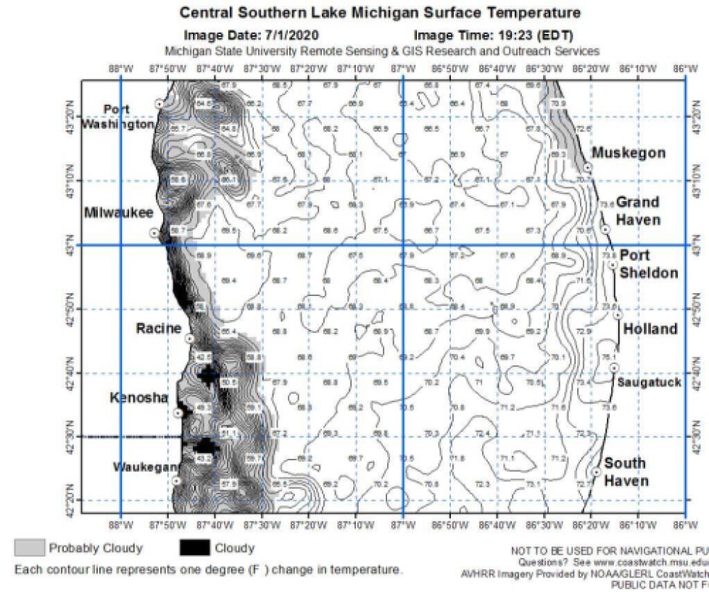
CoastWatch
Check out Great Lakes surface temperatures at CoastWatch. This reporting system is a cooperative project between the NOAA CoastWatch Great Lakes Regional Node located at the NOAA Great Lakes Environmental Research Laboratory in Ann Arbor and the Great Lakes Sea Grant Network.