Lower Grand Watershed Interactive Tool (WIT) - Interactive Mapping
Lower Grand River 319 Project
Nonpoint Source Pollutants
Water Science Education Interactive Mapping
Storm Water Management
Low Impact Development
Government Resources
History of the Watershed
Create a Watershed Management Plan
FYI on Local Water Issues
Rain Gardens
LGRW Implementation Project
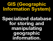
What is a Geographic Information System (GIS)?
Geographic Information Systems are tools used to (1) organize and display spatial information and (2) analyze the spatial impacts of alternative decisions. Their power lies in the ability to manage spatial relationships over time. Because natural resource professionals manage landscapes over space and time, GIS helps managers conceive of and implement management alternatives.
With discrete geographic locations stored in a computer as sets of mathematical coordinates, any type of map can be produced. It is possible to create a map of the world, your neighborhood, or a map of the watershed you live in.
GIS also allows the user to display multiple layers simultaneously and analyze each layer in respect to the other. For instance, a map could display one layer showing soil type, an elevation layer, and a land use layer. By integrating these layers together, a user can decide where the best areas for agriculture would be.
Combining all of these aspects together, GIS can develop models allowing the user to predict processes using sample data. With the use of GIS layers, assumptions about the movements of forces like winds and tides, and other data like average rainfall for an area a user can predict spatially over time the spread of oil slicks, wildfires, or even erosion.
Using GIS in the Lower Grand River Watershed
While GIS is relatively new, many advancements have been made since the first software was available. One such advancement is the capability for distributing GIS and mapping services via the Internet. Using ArcIMS enables users to integrate local data sources with Internet data sources for display, query, and analysis.
The general public, educational institutions, and local decision makers now have access to a variety of data layers for the Lower Grand River Watershed and can use these layers to perform interactive mapping over the Internet. The capabilities and uses of interactive mapping are endless and can be used for a variety of reasons by a variety of people.
Watershed Interactive Mapping (WIM)
Click here for an explanation of the WIM toolbars
Contact Jon VanderMolen at (616) 331-3789 or [email protected] for mapping help.
Source: Lang, Laura. 1998. Managing Natural Resources with GIS. Environmental Systems Research Institute.
Contact:
Grand Valley Metro Council
678 Front St. NW, Ste. 200 Grand Rapids, MI 49503 (616) 776-3876
[email protected]