Lower Grand Watershed Interactive Tool (WIT)

View the Approved 2011 Watershed Management Plan for the Lower Grand River Watershed here.


Introduction
Welcome to the Watershed Interactive Tool (WIT). The WIT is a watershed-based interactive tool for local decision makers, educators, students, and residents of the Lower Grand River Watershed.
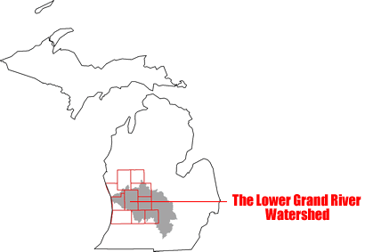
The WIT was developed using materials generated from the Lower Grand River Watershed 319 Project. As a result of that project, a nonpoint source management plan was developed for the entire Lower Grand River Watershed, as well as two Clean Michigan Initiative approved plans for the Sand Creek Watershed and the Buck Creek Watershed.
This tool incorporates information regarding the three management plans, as well as materials on the natural history of the Lower Grand River Watershed (LGRW), interactive maps of the LGRW, general watershed concepts, lesson plans for watershed education, and information on how everyday activities can affect water quality in the LGRW. The WIT can also help local units of government and non-profit entities in writing their own nonpoint source management plan.
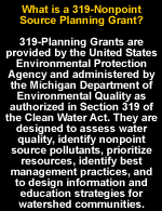
This project has been funded wholly or in part by the United States Environmental Protection Agency under the assistance agreement to the Michigan Department of Environmental Quality. The contents of this document do not necessarily reflect the views and policies of the Environmental Protection Agency, nor does the mention of trade names or commercial products constitute endorsement or recommendation for use.
Contact:
Grand Valley Metro Council
678 Front St. NW, Ste. 200 Grand Rapids, MI 49503 (616) 776-3876
[email protected]
