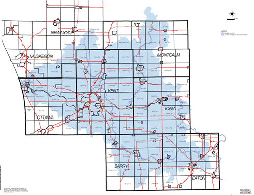
Lower Grand River 319 Project - Study Area
A watershed includes the main river or stream body as well as all of the land that drains to it. It usually has small creeks or drainage ditches that combine to make larger streams or river, which combine to make even larger rivers. In Michigan, these larger rivers empty into the Great Lakes. Large rivers in West Michigan include the Grand River, the Muskegon River, and the Kalamazoo River
Because the Grand River Watershed is so large (covering more than 5,500 square miles) it has been divided into two projects. The Lower Grand River Watershed includes more than 3,020 square miles. It includes the counties of Muskegon, Ottawa, Kent, Montcalm, Ionia, Eaton, Barry, Newaygo, Allegan, and Mecosta.
Project Home Page
Study Area
Project Partners
Info Library
Forum Meetings
Related Projects
Past and Ongoing Events
Project Products
Contact Information