Critical Lands Mapping Project
Results
Products developed for the Critical Lands Mapping Project were tailored for those that are expected to benefit most from a detailed information base. This included specifically the following project partners:
- Cadillac Area Land Conservancy,
- Missaukee Conservation District,
- Wexford Conservation District,
- Osceola Conservation District, and
- Muskegon River Watershed Assembly.
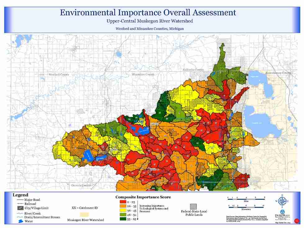
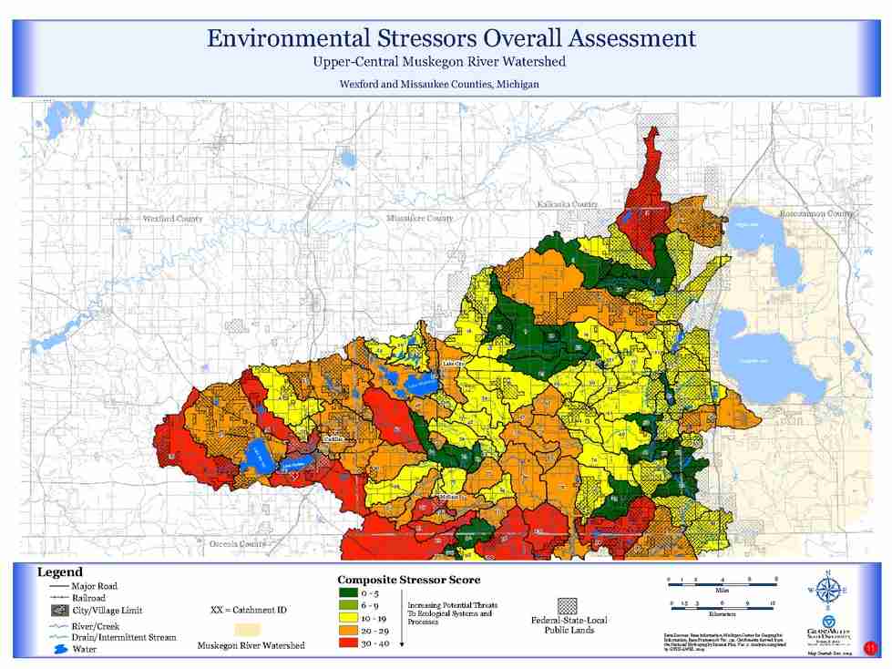
The products created included two map atlases: 1) The Wexford and Missaukee County Area (north region), and 2) The Osceola County Area (south region). Summary maps worth special mention include the Environmental Importance Overall Assessment Map and the Environmental Stressors Overall Assessment Map. Both of these maps prepared for the Wexford and Missaukee County Area are referenced below along with links to download both atlases in their entirety. Please be aware that these are very large files and will require considerable time to transfer.
For more information about the Critical Lands Mapping Project contact Associate Research Scientist John Koches.