

Muskegon County PFAS
STATEWIDE PFAS AWARENESS WEEK September 21-25, 2026
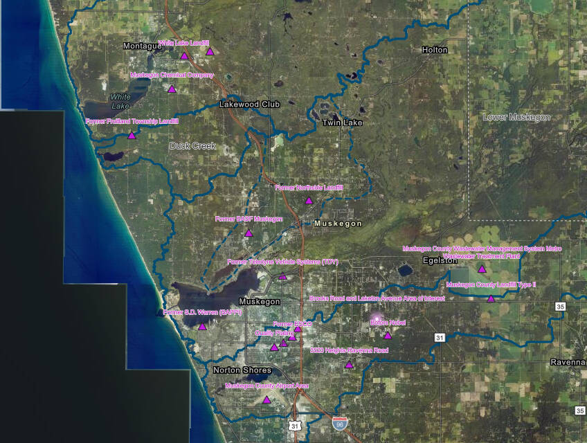
Muskegon County MPART PFAS Sites (19 as of 12/31/25)
Muskegon County MPART PFAS- Link to Interactive (Clickable) GIS Map of Muskegon County PFAS sites with MPART site contact info, site ID/website link, overlaid with nine element watershed management plans
Map Questions/Issues: [email protected]
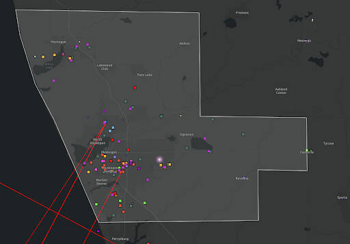
Muskegon County PFAS Exposure Industries
Muskegon County PFAS Exposure Industries -Link to Interactive (Clickable) GIS Map of Muskegon County Specific PFAS Analytic Tools (EPA), Michigan Publicly Owned Treatment Works with PFAS Data (EGLE), and Michigan PFAS Sites and Area Of Interest (MPART)
Map Questions/Issues: [email protected]
Muskegon County PFAS Surface Water Composition
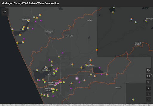
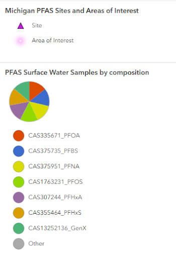
Muskegon County Surface Water Samples by PFAS Composition
PFAS Composition -Link to Interactive (Clickable) GIS Map of Muskegon Specific Surface Water Testing Results (EGLE) symbolized with composition of pfas level results.
Map Questions/Issues: [email protected]
PFAS Glossary
ITRC
PFAS Acronyms
ITRC
MPART
Michigan PFAS Action Response Team
PFAS in Muskegon County Briefing Paper
Tanya Cabala and Dr. Rick Rediske 2026
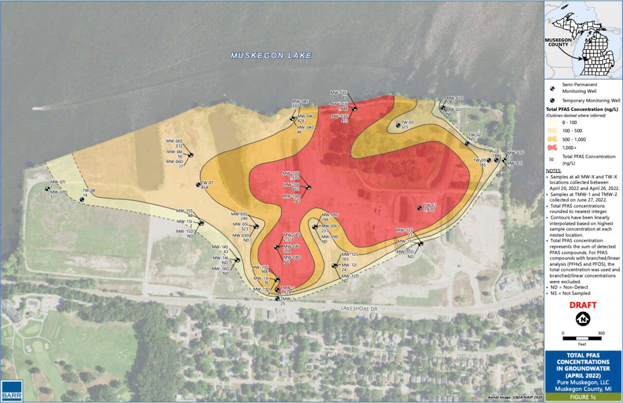
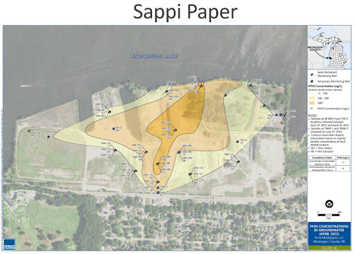
Sappi Paper Mill Total PFAS, PFOAS and PFOS in Groundwater Maps
Pure Muskegon LLC, April, 2022
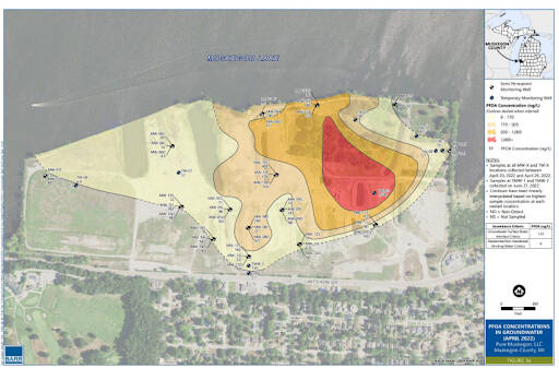
PFOAS
PFOS
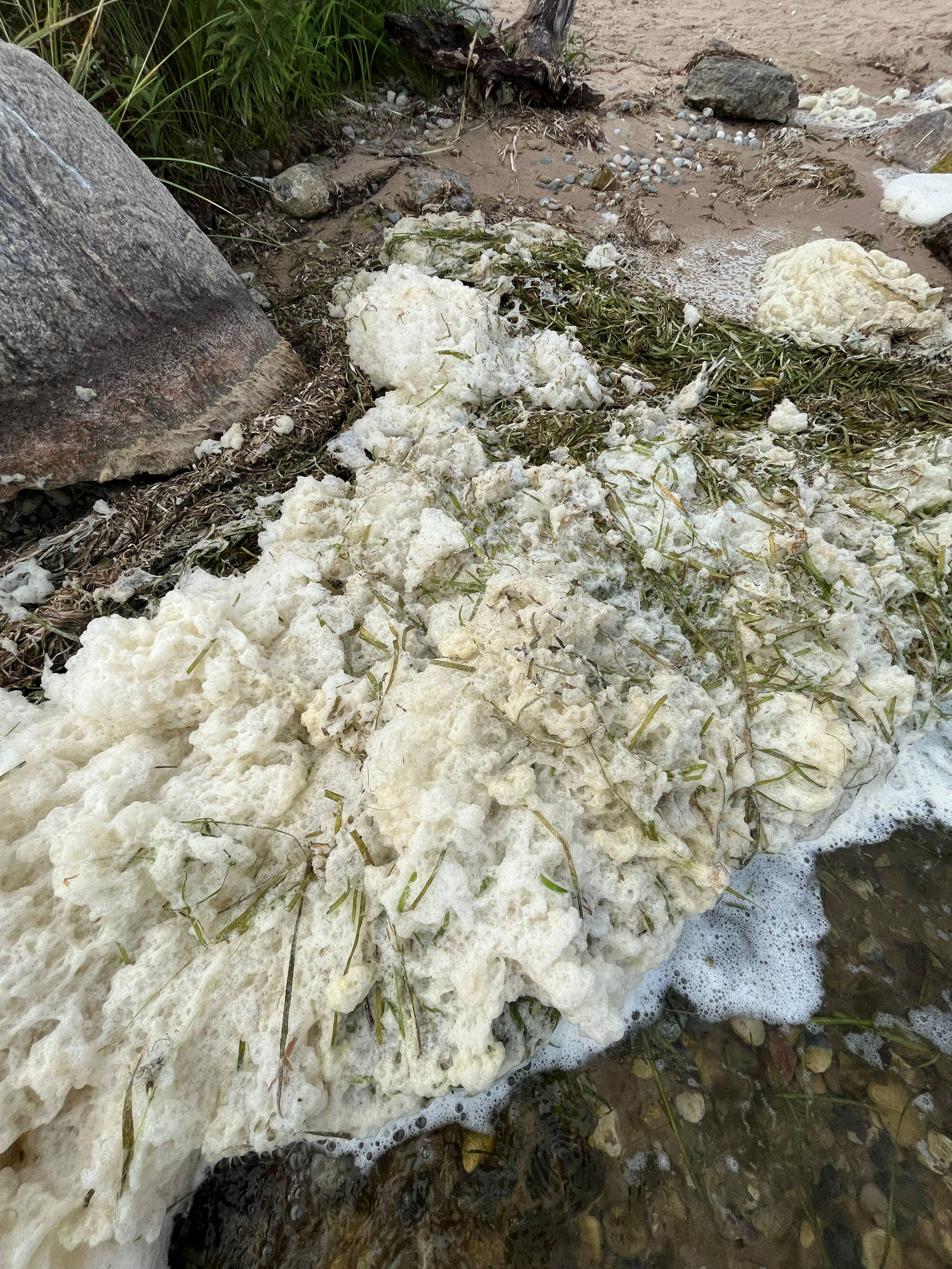
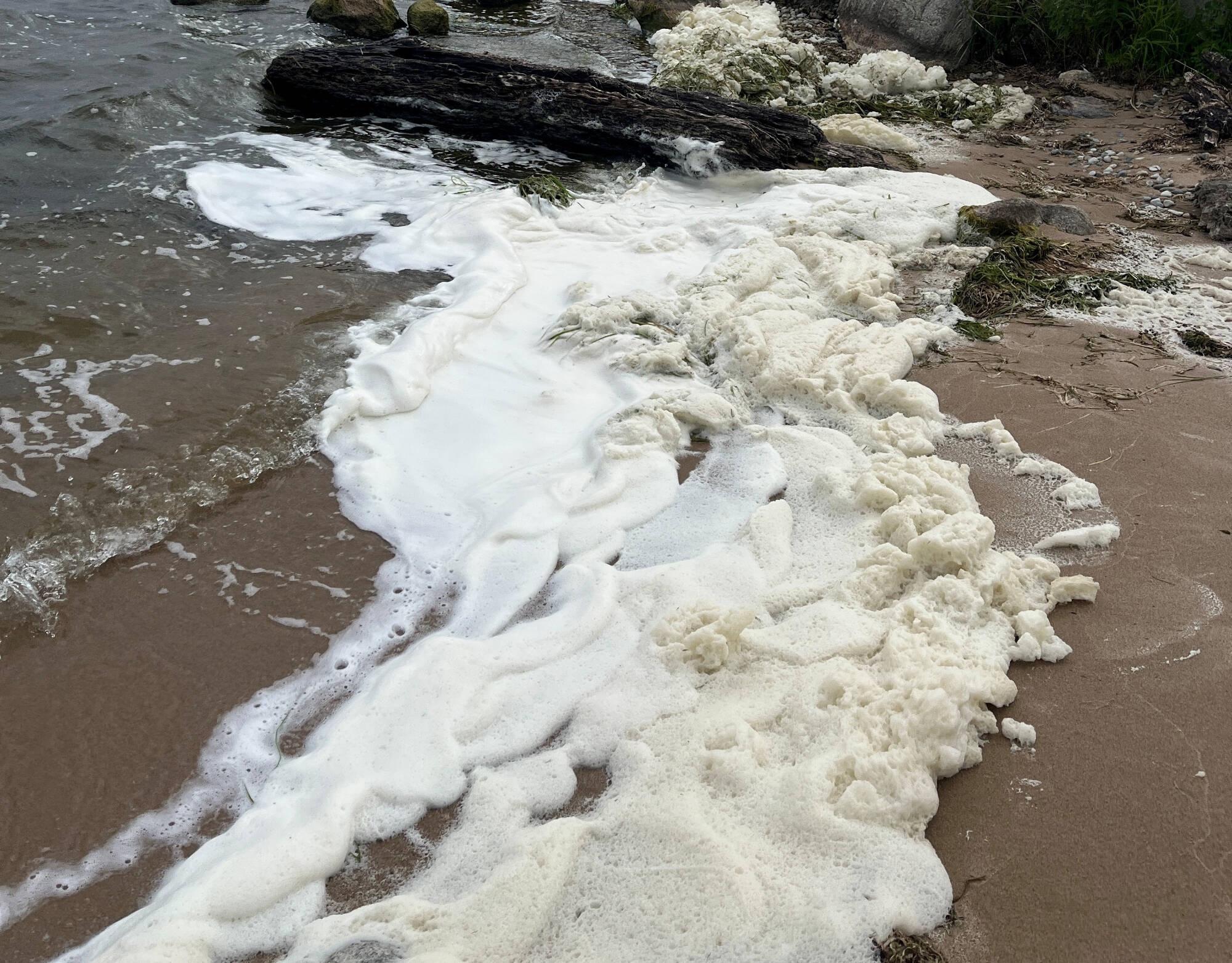
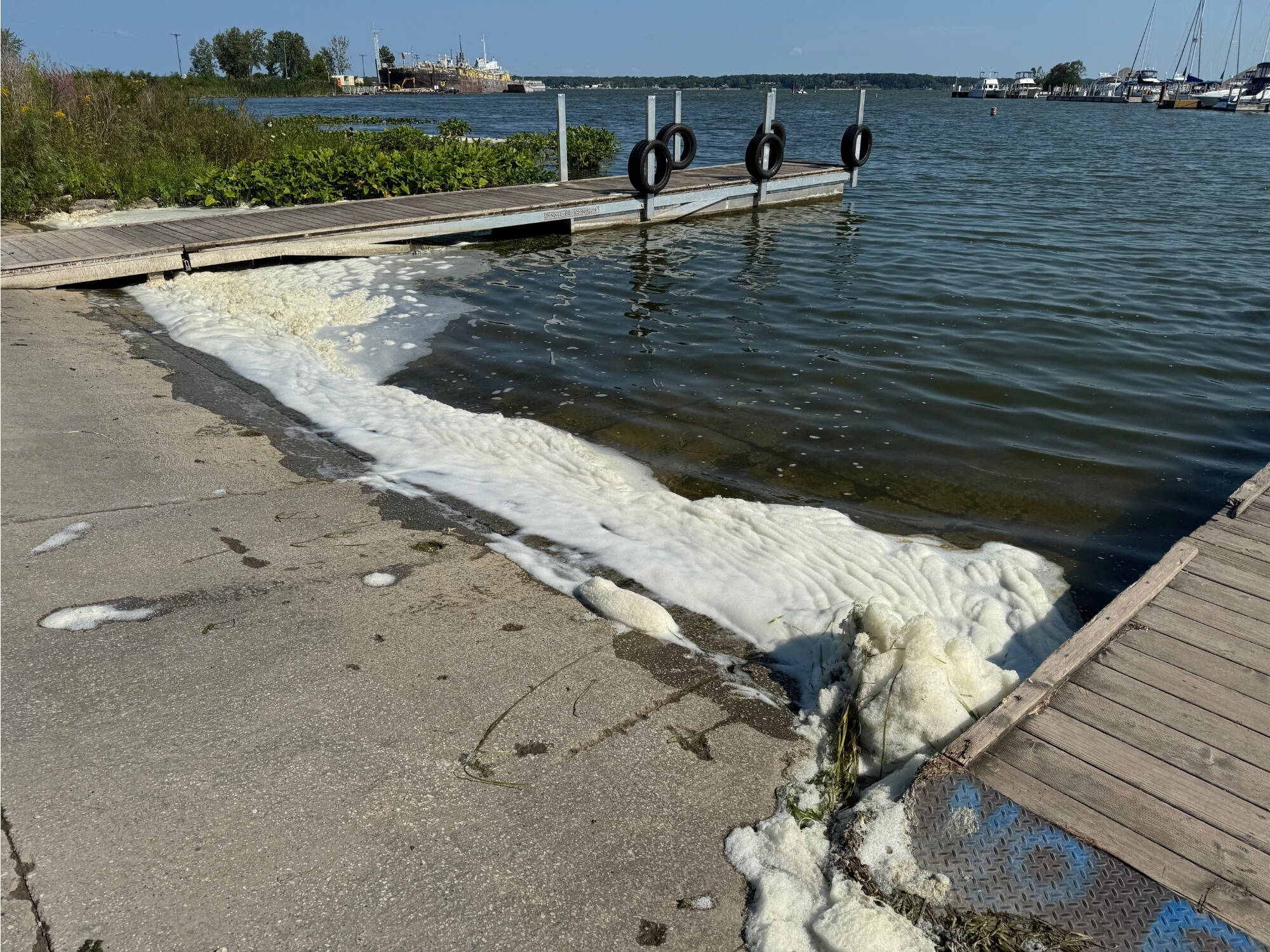
MLIVE We’ve never seen this before.’ High PFAS level found in Muskegon Lake foam Sep. 23, 2024