Flower Creek
Habitat and Fecal Contamination Survey
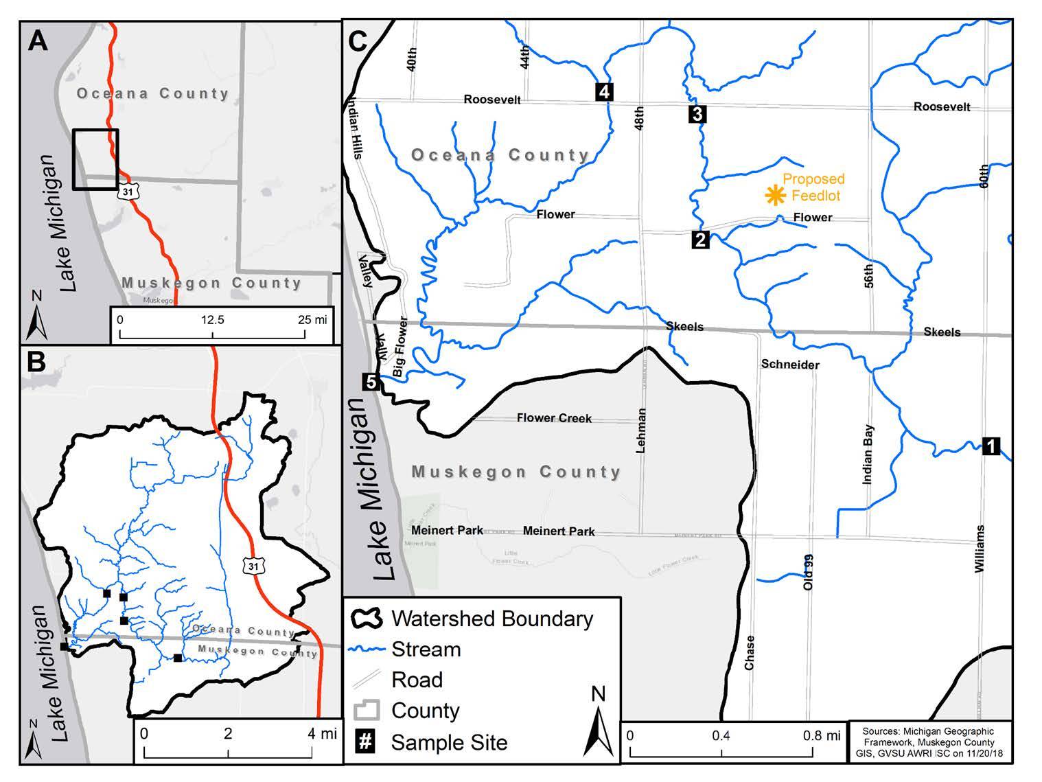
The Flower Creek Watershed has a drainage area of 85.5 km2 (~21,128 acres), and discharges directly to Lake Michigan. Flower Creek (FC) is located in Oceana and Muskegon Counties (Figure 1.1) and is designated a Hydrologic Unit Code (HUC) 12 watershed (#040601011007). AWRI conducted a baseline investigation to determine if Flower Creek met recreational water quality standards for E. coli and if stream conditions supported coldwater fish and benthic macroinvertebrate communities. The assessment was conducted in 2018 and included the following elements:
- Michigan Department of Environmental Quality (MDEQ) Procedure 51 (P51) bioassessments of fish, benthic macroinvertebrates, and stream habitat at 4 locations
- Analysis of E. coli and nutrients at 5 locations (April, August, October)
- Analysis of E. coli for 5 consecutive weeks in August.

The Flower Creek watershed was found to be heavily impacted by sedimentation and agricultural nonpoint source pollution from E. coli. Land cover analysis using Geographic Information System data (GIS) found the watershed was dominated by cultivated crops and pasture. While flood plains in the lower watershed were bordered by wetlands and forest, the middle and upper sections were agricultural with limited riparian buffers. The central part of the watershed contained poorly drained C and D type soils that were mostly agricultural land use. The combination of poor soil conditions, heavy agricultural land use, and poor riparian buffers results in conditions that impact recreational water quality and fisheries. Current agricultural land use practices have resulted in summer exceedances of recreational partial and total body contact criteria for E. coli. The magnitude of the exceedances is enhanced by rain events that cause flooding in the area above the drowned river mouth wetland (FC 004) and the loss of soil, fertilizers, and bacteria from manure application. The 5-week geometric mean for FC 004 in August 2018 was 1402 cfu/100 mls, which exceeded both partial and total body contact standards. Daily geometric means exceeded total body contact standards during baseflow conditions and partial body contact standards during rain events. These results suggest that manure applications are in excess of the topographic, soil, and land cover conditions present in the watershed and a review of agricultural best management practices needs to be conducted to improve water quality.
The Flower Creek Monitoring Project was funded by the Big Flower Creek Association, Reviving Our American Democracy, and the Land Conservancy of West Michigan.
