Assessment of Environmental Stressors in Indian Mill Creek Watershed
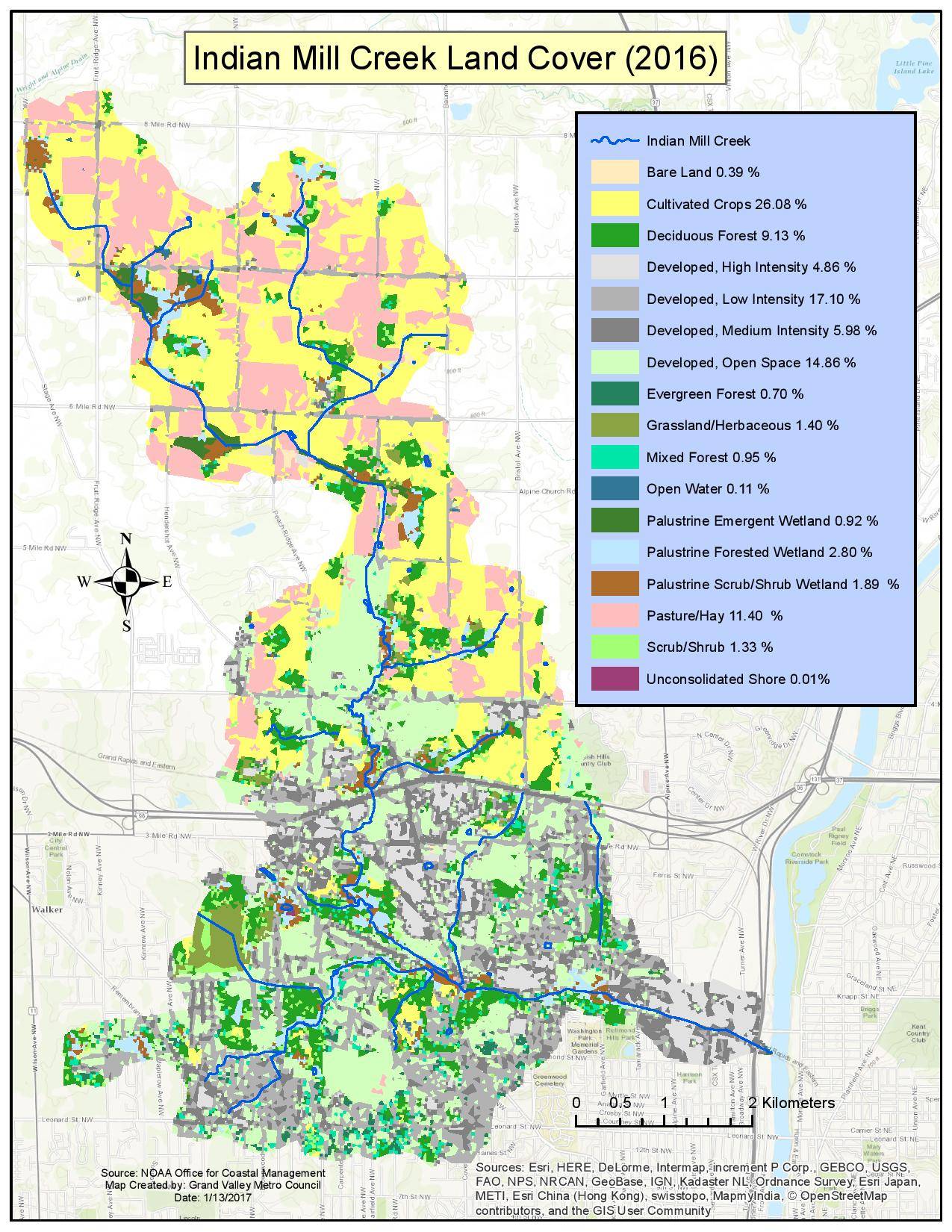
Indian Mill Creek is an agricultural/urban stream located in Kent County, Michigan. Its headwaters originate in the Fruitridge area of Alpine Township and flow through the City of Walker and the City of Grand Rapids before discharging into the Grand River. Indian Mill Creek is a tributary of the Lower Grand River and occupies a drainage area of 10,979 acres. Brandywine Creek, a major tributary of Indian Mill Creek, starts in the City of Walker and flows to the northeast to join Indian Mill Creek. The stream is listed as an impaired waterbody on the State of Michigan’s 303(d) List due to its degraded fish community.

A survey was conducted by the Michigan Department of Environmental Quality in 2009 and found that the lower reach of the creek did not meet coldwater fisheries community standards. The cause of the impairment was not identified in the survey. We conducted a detailed study of physical, biological, and chemical characteristics along with Geographic Information System characterization of land-use change to identify the sources and causes of environmental stressors impacting Indian Mill Creek. We installed scour chains and erosion pins to measure the rates of streambank erosion and sediment deposition. Temperature, bedload sediment transport, and suspended sediment concentration were measured to evaluate whether stream temperature was meeting the coldwater fisheries standards and if sedimentation was impacting the biota of the creek. The toxicity of the stormwater runoff was evaluated using the Microtox assay and Wolman pebble counts were performed to characterize the substrate composition of the river. Similarly, macroinvertebrate surveys and habitat assessments were conducted to evaluate the overall ecological health of the river.
[1552501332].jpg)
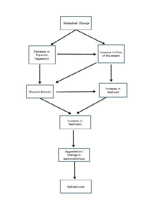
Our results showed that Indian Mill Creek appeared to be meeting the cold moderate or cold stable thermal regime, which was suitable for coldwater fish, such as brown trout, rainbow trout, and white sucker. Stormwater toxicity was determined not to be a factor impacting the biota. Our study showed that the land use was altered significantly since pre-settlement times. The Indian Mill Creek watershed has 12% impervious surfaces and the impervious amount increases to 20% in the urban area below the I-96 highway. The increase in impervious surfaces in the watershed leads to more runoff which causes episodic high flows followed by lower baseflows. The episodic high flows have greater stream power, which increases bank erosion, bedload transport, and the export of woody debris.
The filling of microhabitats of the stream by the sedimentation and loss of woody debris are detrimental to biota of the creek. Amphipod populations decreased by 94% from the stream section above the I-96 highway to Elizabeth Avenue (near the confluence of Grand River). Episodic high flow events also causes channel erosion and changes the morphology of the creek that negatively affects the habitat. Altered hydrology in Indian Mill Creek results in high bedload sediment transport (6680 kg/d) and bank erosion (>60 cm) in the lower reach of the stream and continual deposition of sediment in the channel (aggradation). Aggrading conditions (15-20 cm accumulation using scour chains) were observed at Richmond Park and below the confluence of Indian Mill Creek and Brandywine Creek. Since the temperature is within the cold-moderate category, our results suggest that sediment transport and deposition are the main stressors impacting the coldwater classification.
Reducing stormwater inputs through best management practices, such as rain gardens, bioswales, and detention ponds would help maintain or improve the quality of the stream by promoting infiltration and reducing runoff. Decreasing the amount of impervious surfaces through green infrastructure would help maintain the natural flow regime of Indian Mill Creek. Various best management practices like pervious pavement, rain gardens and detention/retention ponds should be installed to increase infiltration of stormwater runoff. Similarly, reconnection of the creek with its floodplains and restoration of wetlands would provide more opportunities for water storage and reduce the negative impact altered hydrology has on the fish communities.
This project was supported by Grand Valley Metropolitan Council and Annis Water Resources Institute.