Crockery Creek Riparian Corridor
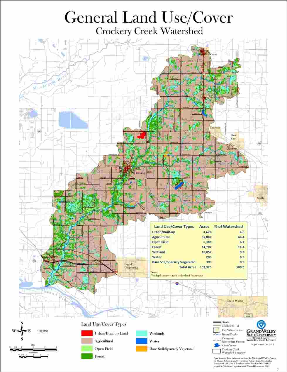
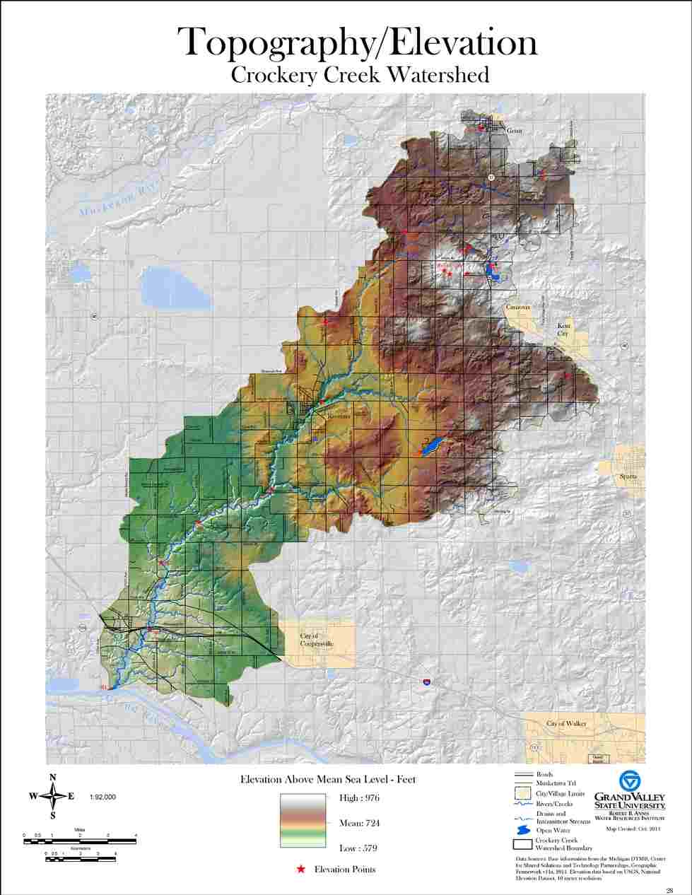
A study of the Crockery Creek Riparian Corridor was funded by the Michigan Department of Environmental Quality and published in January 2012. The map atlas prepared included Land Use and Land Cover, Wetlands, Endangered/Threatened/Special Concern Species, Plant Communities, Public Ownership, and Potential Conservation Areas (PCAs). This investigation also included for the first time an estimate of species “richness” for Vertebrate Animals including: Amphibians, Birds, Mammals, and Reptiles. Special attention was given to endangered, threatened, and special concern vertebrate animals. Historical observations for vertebrate/invertebrate animals and vascular plants were also included in this analysis.
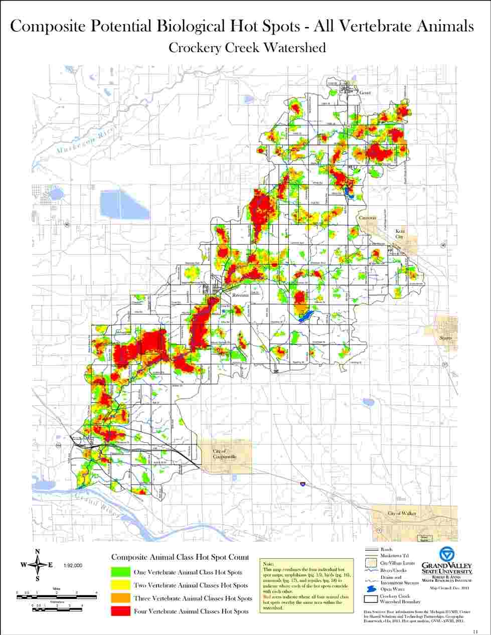
The “Hot Spots” analysis done as part of this project is particularly interesting and provides considerable insight with regard to the distribution of indicator species throughout the Crockery Creek Riparian Corridor.
The atlas can be downloaded using the button below. (Please be aware that this is a very large pdf file and depending on your internet connection could take considerable time to save. If you find that you are having difficulty downloading this file and would still like to receive a copy, feel free to contact John Koches, Associate Research Scientist, and we will make special arrangements.)