2013 Michigan Space Grant
AWRI student, Alex Ebenstein, received a grant from the Michigan Space Grant Consortium as part of their Undergraduate Fellowship Program 2013-2014. Alex wanted to test a previously unexplored use for the AWRI UAV platform. His proposal was to use the UAV equipped with a near infrared (NIR) sensor to estimate the chlorophyll concentrations in Muskegon Lake, Muskegon County, Michigan. The infrared sensor used in this experiment was the TetraCam ADC, which created digital images with three bands similar to bands 2 (green), 3 (red), and 4 (NIR) from Landsat 7 (Figure 1).
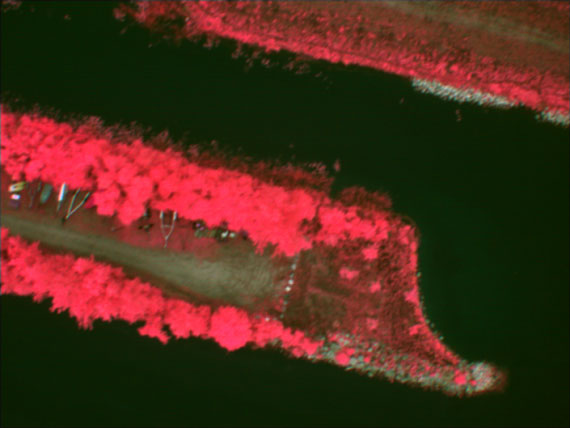
Figure 1 - "False Color" infrared image depicting a portion of Muskegon Lake and its shore. Image collected by AWRI UAV, July 2013
Numerous researchers have successfully estimated the concentration of chlorophyll in both natural lakes and man-made reservoirs using Landsat 7 imagery. The airframe chosen was a commercial off-the-shelf fixed wing aircraft made almost entirely from expanded polypropylene (EPP) foam with a wingspan of 168 cm. Fully equipped and flight ready the aircraft weighs less than 1500 grams including camera payload, batteries, electric motor, flight systems, and autonomous capable autopilot (Figure 2).
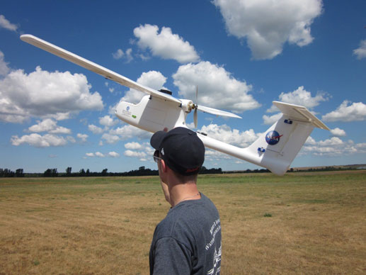
Figure 2 - AWRI/GVSU Student Alex Ebenstein preparing for UAV test flight. Photo taken by John Koches, AWRI Associate Research Scientist, July 2013.
The idea was to capture images of Muskegon Lake using the UAV, and then use regression analysis to compare various ratios of red and infrared bands against the actual measure of chlorophyll concentrations. Figure 3 shows the best ratio and its corresponding regression model using a 2nd order polynomial trendline.
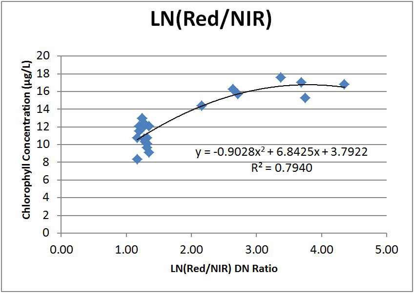
Figure 3 - Chlorophyll concentrations vs. LN(Red/NIR) with resultant trendline and R2 value.