Buoy Location
Google map links:
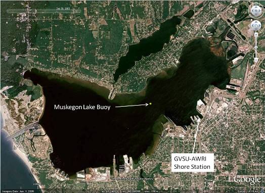
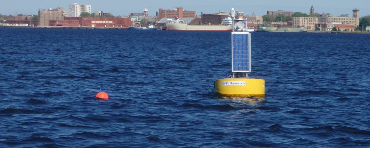
AWRI has selected a site for the buoy system in Muskegon Lake within the proximity of 43.238239° latitude and 86.280532º longitude, a location that corresponds to approximately 12.8 m water depth. This site was selected for the following reasons:
- It is in a central flow path, but outside of the central shipping lane.
- It is located away from the channel to Lake Michigan which, during westerly winds, allows Lake Michigan water to flow into Muskegon Lake.
- The bathymetry of the immediate area and "upstream" from this point are similar,
- The width of the lake narrows in this region which provides more representative water characteristics for the lake in this area, and also provides higher current velocities needed to be detectable by the ADCP during low flow periods.
- It has less fishing and boating pressure.