Lower Grand Watershed Interactive Tool (WIT) - Low Impact Development

Lower Grand River 319 Project
Nonpoint Source Pollutants
Water Science Education
Interactive Mapping
Storm Water Management Low Impact Development
Government Resources
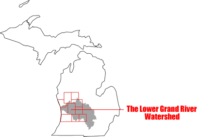
History of the Watershed
Create a Watershed Management Plan
FYI on Local Water Issues
Rain Gardens
LGRW Implementation Project
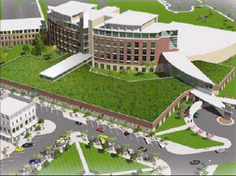
What is Low Impact Development (LID)?
LID is a better way to manage storm water. LID techniques store, filter, and absorb storm water where it falls to mimic natural site conditions. LID keeps large volumes of storm water, and associated pollutants, from reaching our waterbodies.
What are Examples of LID?
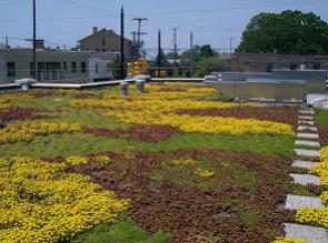
Green Roofs
Green roofs have a vegetative layer of grass, ground cover, or even trees. They absorb rainfall, extend a roof's life, and reduce energy costs.
Native Landscaping
Landscaping with plants that are native to your area means less fertilizer, watering, and care. Native plants have longer roots that absorb more storm water and pollutants than turf grass.
Rain Garden
Rain gardens have a dip at the center to collect, filter, and soak up rainwater. They are planted with native shrubs, wildflowers, and grasses, which need less fertilizer and water than non-native plants.
Grass Swale
Grass swales have a broad, gently sloped channel and thick vegetation. These swales collect and absorb storm water and pollutants.
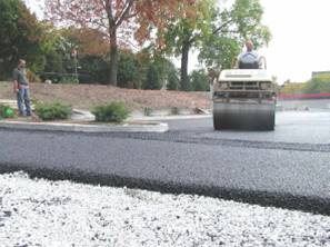
Porous Pavement
Porous pavement has spaces that let rainwater pass through. Because water can soak into the soil, this type of pavement does not create large volumes of storm water runoff.
Storm Water Reuse
Storm water reuse is the recycling of rainwater. Storm water is stored for irrigation or other uses. Through its collection and reuse, storm water does not have to be dumped into the storm sewer.
The practical use of LID practices is directly related to the presents of natural occurring "Green Infrastructure". In other words, LID placement takes advantage of exiting wetlands, hydrology, topographic features, and other characteristics in the natural landscape. To download an interactive map showing West Michigan Green Infrastructure click here. (Adobe 9.0 or above required)
Click here for an instruction sheet useful in manipulating the above map.
To download a poster describing the relationship between Green Infrastructure and LID practices click here.
For information on LID practices in Greater Grand Rapids click here.
This project has been funded wholly or in part by the United States Environmental Protection Agency under the assistance agreement to the Michigan Department of Environmental Quality. The contents of this document do not necessarily reflect the views and policies of the Environmental Protection Agency, nor does the mention of trade names or commercial products constitute endorsement or recommendation for use.
Contact:
Grand Valley Metro Council
40 Pearl St. NW, Ste. 410 Grand Rapids, MI 49503 (616) 776-3876
[email protected]