Critical Lands Mapping Project - Lower Muskegon River
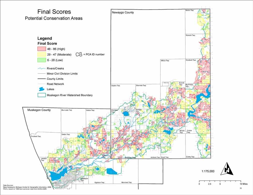
In 2008 AWRI published the map atlas titled, “Critical Lands Mapping Project – Lower Muskegon River Watershed.” The project was funded by the Fremont Area Community Foundation as part of the Ice Mountain Environmental Stewardship Fund. The primary goal of this effort was to identify Potential Conservation Areas (PCAs) that were considered high priority natural lands within the Lower Muskegon River Watershed. These natural lands are essential to the maintenance and protection of the natural character of the Muskegon River and its watershed by proving critical ecological services. Of particular importance is the identification of PCAs that protect water quality, tend to help stabilize hydrologic flows, and provide habitat for plants and animals. The project identified 533 land “patches” as PCAs and used eleven criteria to rank their importance. The eleven criteria included:
- Land Area
- Core Area Size
- Connectivity to Surrounding Landscape
- Within Riparian Corridor
- Contains Cold Water Stream Tributary
- Prime Fish Spawning Area
- Wetland
- Ground Water Recharge
- Biological Rarity
- Historic Significance
- Ownership/Fragmentation
Each of the eleven criteria had its own map showing the ranking of each land area patch. The use of Geographic Information Systems allowed the combination of all criteria maps into one summary map ranking each of the 533 PCAs. That map can be downloaded here. The entire atlas is also available and can be downloaded using the button below. (Please be aware that this is a very large pdf file and depending on your internet connection could take considerable time to save. If you find that you are having difficulty downloading this file and would still like to receive a copy, feel free to contact John Koches, Associate Research Scientist, and we will make special arrangements.)